 English
 العربية
 Deutsch
 Español
 Français
 हिन्दी
 Bahasa Indonesia
 Italiano
 日本語
日本語 한국어
한국어 Polski
 Português (Brasil)
 Русский
 Türkçe
 Українська
 简体中文
简体中文Learn
How is a mountain’s height actually measured?
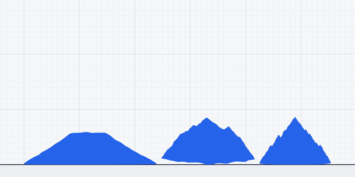
To measure a mountain’s height today, surveyors fix the summit with GNSS and convert its position to elevation above a vertical datum; K2 is listed at 8.61 km (5.35 mi) above sea level. Before satellites, surveyors calculated summit height from a measured ground baseline and angles sighted to the peak, then tied the result to a sea-level reference.
Mountain elevations describe how high a summit sits above that reference, not how far it rises from the nearby valley. Mount Kilimanjaro is listed at 5.89 km (3.66 mi) above sea level. K2’s 8.61 km elevation is about 10 times the height of the Burj Khalifa.
What does mountain height mean?
A map’s elevation is the summit’s vertical position relative to a defined surface. Local relief asks a different question: how far the peak rises above nearby land. K2’s elevation above sea level does not tell you how much rock stands above the valley at its foot. For that, the starting point would have to be the valley, not the shared reference used for mapped elevations.
Sea level is not a flat sheet that can be extended under every mountain. The ocean surface is affected by gravity and Earth’s shape, so surveyors use a model of a level surface rather than a nearby beach as their reference. A geoid models a gravity-based surface that approximates mean sea level. A vertical datum provides the agreed reference for reporting elevations on maps. The National Geodetic Survey’s explanation of geodetic leveling (opens in a new tab) describes how surveyors connect heights to those references. The same care about what a measurement means applies to how we measure sizes.
The point at the summit also matters. A snow-covered peak has a surface above its underlying rock, and a broad ridge may have more than one plausible high point. A reported elevation needs to identify the summit position and the surface being measured, rather than treating every point near the top as interchangeable.
How did surveyors measure peaks before satellites?
Before satellite positioning, surveyors built a triangle between a measured baseline and the distant summit. They measured the distance along accessible ground between survey stations, then sighted the peak from those known positions and measured the angles. With the baseline and angles, trigonometry gives the triangle’s shape: surveyors can calculate how far away the summit lies and how much higher it is than the stations. The U.S. Geological Survey’s account of historical peak surveys (opens in a new tab) explains the field methods and their limits.
The summit did not have to be climbed for that calculation. Surveyors needed stable stations with a clear view, which could mean hauling instruments onto ridges and finding sightlines through difficult terrain. They also had to know the elevation of their stations. Leveling from a known benchmark could establish that starting height; the angle calculation then gave the summit’s height relative to it. The long walk helped establish the geometry, while the mathematics carried the measurement to a peak beyond reach.
A plumb line helped set the instrument’s local vertical. Gravity pulls the line downward, giving the surveyor a reference for aiming and measuring angles. It does not measure the mountain directly. The summit’s elevation comes from the surveyed distance, the sighting angles and the known elevation of the station, combined through the geometry of the triangle.
A sightline across a valley is not like a straight ruler laid on a table. Earth curves beneath the line, and air bends light, changing the apparent angle to a distant summit. Surveyors correct for Earth’s curvature and atmospheric refraction so those effects do not distort the calculated height. The direction of local vertical also follows gravity, which varies across Earth. These corrections matter because the instrument measures angles along a real line of sight, not an ideal line on a flat map.
Photogrammetry added another way to map a summit. Surveyors used overlapping photographs and control points with known positions to build a model of the terrain. That could help locate a high point when a clear ground sightline was hard to establish, but the result still depended on the quality of the control points and the interpretation of the images.
How do GPS and satellite data measure height today?
A surveyor can carry a GNSS receiver to a summit and use signals from navigation satellites to determine the receiver’s position. GPS is one satellite navigation system used within GNSS. The receiver’s antenna sits on a physical surface, so the surveyor must account for the antenna’s position above the snow or rock being measured. GPS.gov’s guide to GPS surveying (opens in a new tab) explains how satellite positioning differs from conventional line-of-sight methods.
The receiver first calculates height relative to a smooth mathematical surface called an ellipsoid. That surface is useful for positioning, but it is not the gravity-based geoid used to express elevation above sea level. A geoid model gives the difference between those surfaces at the summit. Surveyors use that difference to convert the receiver’s ellipsoid height into an elevation tied to the chosen vertical reference. The ellipsoid is the positioning surface; the geoid helps connect that position to the sea-level elevation people expect from a map.
A datum makes the converted elevation consistent with the reference used for a map or survey. It is not simply a label attached to a satellite reading: surveyors need a defined reference system and a model that relates the receiver’s position to it. That is why a GPS coordinate alone is not automatically the final mountain elevation. The receiver locates the antenna; the geoid model and vertical datum turn that position into the reported elevation.
Satellite images and radar-derived terrain models can help map ridges and identify candidate high points, especially where ground access is difficult. But a radar image does not simply read a summit’s elevation above sea level. The terrain model needs a vertical reference, and its mapped surface may represent snow, vegetation or rock differently from a receiver placed directly at the point being measured. For a summit like K2, locating the highest point and defining the surface are part of making the measurement, not details a picture settles on its own.
Why can a mountain’s reported height change?
A new figure can result from improved positioning, a better model of the geoid, or a more precise choice of summit point. Snow and ice can also change the surface that a survey measures. Those explanations describe a measurement being updated; they do not mean the mountain itself has suddenly changed height. A useful report identifies what point and surface were measured, as well as the reference used for the elevation.
Mount Everest is listed at 8.85 km (5.5 mi) above sea level. That familiar elevation, like the figures for K2 and Kilimanjaro, is a summit elevation tied to a sea-level reference. Different surveys can refine the position or the way that reference is applied without changing the mountain’s physical outline.
The U.S. Geological Survey’s Denali elevation update (opens in a new tab) makes the role of summit snow concrete. The GPS observation was made at the snow-covered summit, and the team also used radar to measure snow depth, distinguishing the surface from the rock beneath it. USGS reported Denali at 20,310 feet, replacing the previous 20,320 feet, a reduction of 10 feet.
Related sizes
Things this article is about, with their sizes.
Sources
- National Geodetic Survey, NOAA: What is Geodetic Leveling? (opens in a new tab) geodesy.noaa.gov
- U.S. Geological Survey: Why are mountain peak elevations not shown on US Topo maps? (opens in a new tab) usgs.gov
- GPS.gov: GPS for Surveying (opens in a new tab) gps.gov
- U.S. Geological Survey: New Elevation for Nation’s Highest Peak (opens in a new tab) usgs.gov
- Encyclopaedia Britannica, K2; National Geographic, K2
- Tanzania National Parks Authority — Mount Kilimanjaro; Encyclopaedia Britannica — Mount Kilimanjaro