 English
 العربية
 Deutsch
 Español
 Français
 हिन्दी
 Bahasa Indonesia
 Italiano
 日本語
日本語 한국어
한국어 Polski
 Português (Brasil)
 Русский
 Türkçe
 Українська
 简体中文
简体中文Learn
How did Eratosthenes measure the Earth with a stick?
Eratosthenes estimated Earth's circumference at 250,000 stadia (opens in a new tab) by comparing noon shadows in Alexandria and Syene, two Egyptian cities. He treated their shadow-angle difference, about 7.2 degrees, as one-fiftieth of a circle, then multiplied the reported distance between the cities by 50.
The key was geometry: sunlight reaching Egypt can be treated as parallel, while a vertical stick points toward Earth's centre. That makes the angle shown by a shadow at Alexandria match the angle between the cities as seen from Earth's centre.
Two cities, one surprising difference
Eratosthenes worked in Alexandria during the Hellenistic period, more than 2,200 years ago (opens in a new tab). The comparison paired the Mediterranean port with Syene, near modern Aswan in southern Egypt. Egypt's geography gave the calculation its long baseline: the cities sit far apart along the Nile, broadly north and south of one another.
The familiar account places the observation at noon on the summer solstice. At Syene, the Sun was said to shine straight down a deep well, leaving no shadow from a vertical object. At the same time in Alexandria, a vertical stick cast a shadow. The Smithsonian account of Eratosthenes' measurement (opens in a new tab) describes this contrast and the angle used in the calculation.
The story comes through the later writer Cleomedes, rather than a surviving record by Eratosthenes (opens in a new tab). That makes the observation second-hand evidence, not a laboratory notebook. The report still gives a clear account of the idea: a local shadow can reveal how much the ground's direction changes between distant places.
How a shadow reveals Earth's central angle
A vertical stick and the length of its shadow set the proportions of a right triangle; the slant of the sunlight supplies the remaining line. From the triangle, the angle between the stick and the Sun's rays can be inferred. The stick did not need to stretch across Egypt. Its job was to mark the local vertical in Alexandria.
At Syene, the reported overhead Sun meant sunlight followed the local vertical. At Alexandria, the vertical stick leaned away from the incoming rays by the angle revealed by its shadow. Since sunlight arrives in nearly parallel rays across Egypt, the difference between the cities' vertical directions matches the angle between their directions from Earth's centre (opens in a new tab). The stick's shadow therefore measures a local angle that corresponds to a slice of the planet's curve.
The timing matters. Local noon is when the Sun crosses the local north-south meridian, so its shadow gives the angle in the direction relevant to the route between the cities. The summer-solstice observation matters because the account places the Sun directly overhead at Syene then. Without that reference point, the calculation would need to account for the Sun's angle at Syene as well.
A full circle measures 360 degrees. The reported 7.2-degree angle is one-fiftieth of that turn. If the route between Syene and Alexandria represents one-fiftieth of Earth's curve, its length can be multiplied by 50 to estimate the circumference. The Smithsonian description sets out this one-fiftieth-circle step in the calculation.
How the city distance scales up
The other ingredient was the reported distance from Syene to Alexandria: 5,000 stadia. Multiplying 5,000 stadia by 50 gives 250,000 stadia for Earth's circumference. The Carnegie Institution's explanation (opens in a new tab) describes how Eratosthenes combined the measured distance with the shadow angle. The multiplication, rather than any attempt to trace the whole planet, did the work of scaling up.
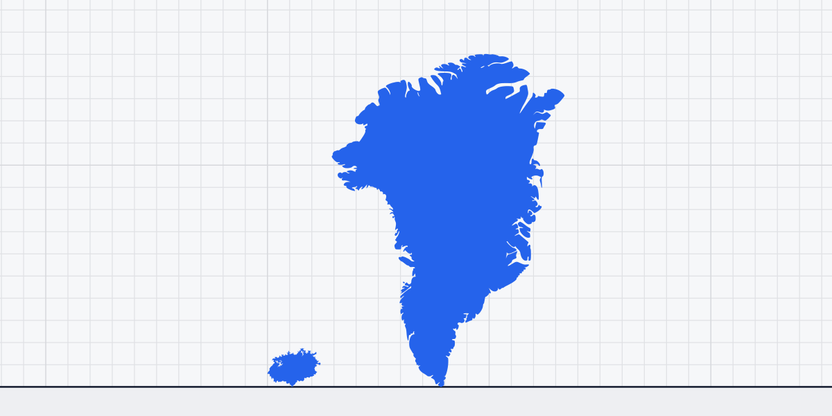
A modern rough rendering of the city distance is about 800 km. That helps picture the baseline, though the calculation itself used stadia and a multiplier. Greenland's maximum east-west width is 1,050 km (652 mi), while Lake Victoria's maximum width is 240 km (149 mi). The Egyptian distance falls between those familiar spans.
Why the stadion changes the answer
The calculation produces a result in stadia, an ancient unit whose length was not fixed everywhere. Historians cannot identify with certainty which stadion Eratosthenes used. On a generous reading, one stadion was about 157.5 m (opens in a new tab). At that length, 250,000 stadia converts to about 39,375 km.
Earth's circumference is roughly 40,000 km (opens in a new tab), so that conversion puts Eratosthenes within a few percent. But the close match depends on the chosen stadion. Keep the count of stadia fixed and choose a shorter unit, and the kilometre estimate shrinks; choose a longer unit, and it grows. The shadow geometry can be clear while its conversion into modern units remains uncertain.
The Union University discussion of the estimate (opens in a new tab) explains how proposed stadion lengths affect the result. Modern measurements also need a stated unit and clear endpoints, the principle behind how size measurements are defined.
What the estimate can and cannot show
The reported geometry assumes the route between Alexandria and Syene follows a north-south arc. The cities are not perfectly aligned that way — Alexandria is actually a couple of degrees of longitude west of Syene, not due north of it — so a travel distance does not exactly match the distance along a meridian (opens in a new tab). Along with the uncertain stadion, those details limit how precisely the ancient result can be compared with a modern circumference.
Still, the method's essential move is visible in the reported figures. A shadow angle of about 7.2 degrees marked one-fiftieth of a circle; the 5,000-stadia route, multiplied by 50, became a 250,000-stadia circumference. A stick stayed in Alexandria, while its angle let a measured stretch of Egypt stand for the curve of the whole Earth.
Related sizes
Things this article is about, with their sizes.
Sources
- National Museum of American History, Smithsonian Institution: Painting - Measurement of the Earth (Eratosthenes) (opens in a new tab) americanhistory.si.edu
- Carnegie Institution for Science: Eratosthenes (opens in a new tab) cosmology.carnegiescience.edu
- Union University: How did mankind first determine the size of the Earth, and what are the known values today? (opens in a new tab) uu.edu
- Encyclopaedia Britannica — Greenland; National Geographic — Greenland
- Encyclopaedia Britannica — Lake Victoria; World Lake Database — Lake Victoria
- MacTutor History of Mathematics, University of St Andrews: Eratosthenes of Cyrene (opens in a new tab) mathshistory.st-andrews.ac.uk
- American Physical Society: This Month in Physics History — Eratosthenes Measures the Earth (opens in a new tab) aps.org
- Ancient Ports – Antiques: Ancient Units of Measurement (Egyptian stadium) (opens in a new tab) ancientportsantiques.com
- Ohio State University Department of Astronomy: Aristarchus and Eratosthenes (lecture notes) (opens in a new tab) astronomy.ohio-state.edu
- American Educator (American Federation of Teachers): Joy Hakim, “How Did Eratosthenes Come So Close?” (Fall 2004) (opens in a new tab) aft.org